Community
11 June, 2024
Rainforest track opens
THE Cape Tribulation Bloomfield Road, which has been closed since mid-December due to extensive damage caused by Tropical Cyclone Jasper, is re-opening later this month.

A Douglas Shire Council spokesman said it would be a boost for adventurous families, re-opening in time the June/July school holidays.
He said 48 sections of the road were damaged.
“Crews have been on site since early January 2024 to restore to its previous condition as a 4WD track and council can confirm it will be open to the public by June 22,” the spokesman said.
He said Cape Tribulation Bloomfield Road, which links Cape Tribulation to Wujal Wujal, was considered one of Australia’s most scenic and challenging drives.
“An alternative to the inland road via the sealed Mulligan Highway, this 4WD route travels through the heart of the Wet Tropics and features world-heritage listed rainforest, waterfalls, creek crossings, rainforest-clad ranges and stunning views,” the spokesman said.
“It’s also a vital access route for Degarra residents wanting to travel to Mossman and Cairns.
“Restrictions on Cape Tribulation Road have also been relaxed with the length restriction for articulated vehicles increased from 12.5m to 15.1m.
“This will mean more camping trailers and caravans will be able to travel across Alexandra range to Cape Tribulation Village, ahead of the school holidays.”
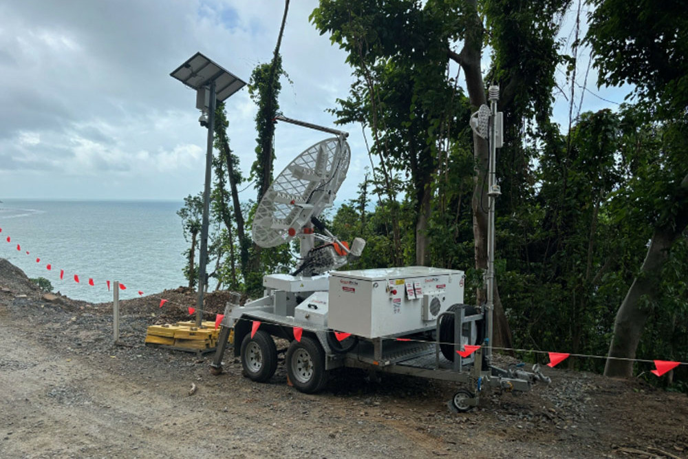
In the meantime, radar equipment – which would look more at home on the moon’s surface rather than in the Daintree – is making a vital stretch of the road safer and more accessible for motorists.
The council spokesman said ‘The GroundProbe radar’ would provide 24/7 live monitoring of the slip face at Noah Range and will alert the council to any movements of the mass that has yet to come down.
The detection technology is used by Rio Tinto and other mining companies.
Douglas Shire Mayor Lisa Scomazzon said Noah Range was now open until midnight each day.
“The safety of the local community, tourists and council staff has been our priority since recovery works began on Noah Range,” she said.
“This technology has given the council confidence to extend access hours – the radar’s live monitoring means we can monitor any movement at the slip face late at night outside of daylight hours.”
The council is working with engineers and the Queensland Reconstruction Authority on the final rectification works at Noah Range.


